Satellite Analysis Reveals Unprecedented Cloud Cover Across India: Assessing the Impact on Monsoon Progress
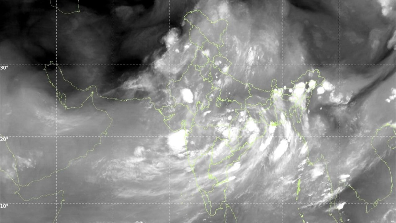
Recent satellite imagery captured by the Indian Space Research Organisation (ISRO) has revealed a striking meteorological phenomenon: approximately 90 percent of the Indian subcontinent is currently blanketed by dense cloud cover. This widespread atmospheric saturation signals a significant shift in the monsoon circulation, capturing the attention of both meteorologists and the agricultural community. As the nation remains under this expansive canopy of clouds, questions regarding the intensity, distribution, and duration of the impending rainfall are at the forefront of national discourse.
The satellite data, processed through advanced remote sensing technology, depicts a unified weather system spanning from the northern Himalayan foothills to the southern peninsular regions. Such extensive coverage is rarely observed simultaneously across the entire country, suggesting a highly active monsoon trough and the convergence of moisture-laden winds from both the Arabian Sea and the Bay of Bengal. For farmers, this visual evidence of atmospheric moisture is a welcome sign, yet it brings with it the complexities of uneven precipitation distribution and the potential for localized weather extremes.
Understanding the Mechanics of Widespread Cloud Formation
The presence of 90 percent cloud cover is indicative of a robust influx of moisture into the lower and middle levels of the atmosphere. Meteorologically, this occurs when low-pressure systems interact with regional topographical features, forcing air to rise, cool, and condense. The current satellite readings suggest that the monsoon is not merely active but is operating with significant depth, meaning the air mass is saturated with moisture to a considerable altitude.
However, meteorologists urge caution in equating cloud cover directly with uniform rainfall. While the clouds provide the necessary raw material for precipitation, the actual volume of rain that reaches the ground depends on local temperature gradients, vertical wind shear, and the presence of "orographic lift"—the process where air is forced over mountain ranges, triggering heavy localized downpours. In flat, inland regions, cloud cover can sometimes persist for days without resulting in significant rainfall, creating a "grey-sky" effect that may actually suppress daytime temperatures and impact the evapotranspiration rates of standing crops.
The Relationship Between Satellite Data and Precipitation Forecasts
Predicting the exact outcome of such an expansive weather system requires analyzing the movement and density of these cloud masses over the next 48 to 72 hours. ISRO’s imagery serves as a critical diagnostic tool, but it must be paired with ground-level observations of pressure and humidity. The primary concern during such events is the potential for "stalled" systems, where heavy rain remains concentrated over one region for an extended period, leading to the risk of waterlogging or flash flooding, while other regions remain under heavy cloud but receive only light, intermittent drizzles.
For the agricultural sector, the current satellite data suggests a period of transition. If the cloud cover remains stable, it will likely lead to widespread, moderate rainfall across the major grain-producing belts. Conversely, if the system begins to shift rapidly, it could trigger intense convective storms. The satellite imagery provides the "big picture" that helps regional meteorological centers refine their district-level forecasts, allowing for more precise warnings regarding heavy rainfall alerts.
What This Means for Farmers
For the farming community, the current meteorological situation presents both opportunities and critical management challenges. Understanding the implications of this widespread cloud cover is essential for safeguarding harvests and optimizing field operations:
- Monitor Soil Moisture Levels: Extensive cloud cover reduces direct sunlight, which slows down the rate of soil evaporation. Farmers should avoid over-irrigating during this period, as the soil may remain saturated for longer than usual, increasing the risk of root rot in sensitive crops.
- Pest and Disease Management: High humidity and persistent cloud cover create an ideal environment for fungal pathogens and certain insect pests. Crops such as pulses and oilseeds are particularly vulnerable to blight and rust under these conditions. Producers should be prepared to scout fields frequently and consider preventative measures if weather conditions persist.
- Logistics and Harvest Planning: If crops are currently at the harvesting stage, the forecast of widespread rain necessitates an immediate shift in strategy. Farmers should aim to accelerate harvesting activities where possible or ensure that harvested produce is stored in covered, ventilated areas to prevent spoilage from high humidity.
- Strategic Fertilizer Application: Heavy rainfall can lead to the leaching of nitrogen-based fertilizers. It is advisable to delay top-dressing applications until the immediate threat of intense, sustained rainfall has passed, ensuring that nutrients are absorbed by the plants rather than washed away from the root zone.
- Stay Informed via Local Updates: While satellite imagery provides a national perspective, local weather variations can be significant. Farmers are encouraged to rely on district-level agromet advisories, which integrate these high-level satellite insights with local soil and crop health data to provide actionable, site-specific guidance.