Severe Weather Alert: Gujarat Braces for Torrential Rainfall and High-Impact Storms
The India Meteorological Department (IMD) has issued a high-level Red Alert across Gujarat, signaling the onset of a period of intense atmospheric instability. As of August 2, the state is bracing for a series of severe weather events, including torrential downpours, widespread thunderstorms, and gusty winds. This meteorological shift, driven by a combination of active monsoon currents and localized low-pressure systems, poses significant risks to low-lying regions, critical infrastructure, and the state’s agricultural sector.
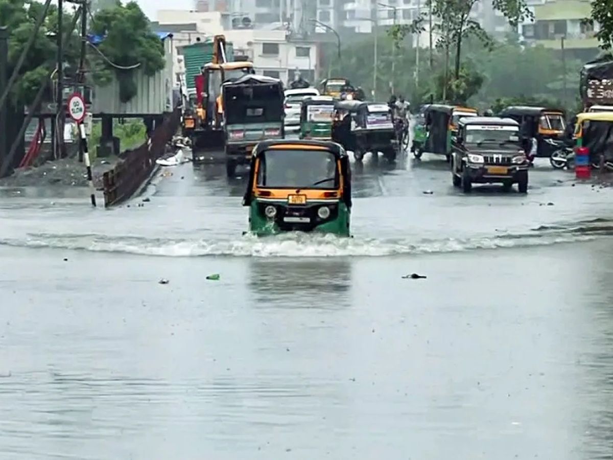
State disaster management authorities have been placed on standby as meteorological models indicate that several districts will experience "very heavy to extremely heavy" rainfall. The combination of saturated soil conditions from previous monsoon activity and the forecasted influx of moisture is expected to exacerbate the risk of flash flooding and waterlogging in urban and rural centers alike. Residents and stakeholders are being urged to remain vigilant and adhere to official advisories as the situation evolves over the coming 48 to 72 hours.
Meteorological Dynamics and Regional Impact
The current weather disturbance is characterized by a robust inflow of moisture from both the Arabian Sea and the Bay of Bengal, which is fueling deep convective cloud formations over the Gujarat region. These systems are not only bringing heavy precipitation but are also accompanied by high-velocity winds that can cause structural damage and disrupt power supply lines. The IMD’s Red Alert underscores the severity of the forecast, as individual pockets may receive rainfall totals that exceed seasonal norms within a very short duration.
The impact is expected to be widespread, affecting both coastal and inland districts. Coastal areas are particularly vulnerable to high-velocity gusts and potential sea-state disturbances, which may hinder local maritime and fishing activities. Inland, the focus is on the rapid accumulation of surface water. Agricultural landscapes, particularly those in low-lying plains, are at risk of inundation, which can lead to severe soil erosion and the leaching of essential nutrients. Meteorological experts are closely monitoring the trajectory of the storm cells to provide real-time updates as the intensity of the downpours fluctuates throughout the day.
Infrastructure and Public Safety Protocols
In response to the IMD’s warning, local administrations have activated emergency response protocols. Public safety is the primary concern, with officials advising against unnecessary travel, particularly in areas prone to sudden flooding or landslides. Educational institutions, as well as public works departments, are monitoring the stability of infrastructure, including roads and bridges, which may be compromised by the sheer volume of water expected to flow through drainage basins.
Power distribution companies have been alerted to the possibility of outages caused by gusty winds and lightning strikes. Maintenance crews are being positioned in strategic locations to ensure that critical services, including hospitals and emergency communication networks, remain functional. Authorities are also emphasizing the importance of clearing drainage channels in urban areas to minimize the risk of prolonged waterlogging, which can lead to health hazards and significant economic disruption.
What This Means for Farmers
For the agricultural community, this period of extreme weather presents significant logistical and agronomic challenges that require immediate attention:
- Crop Protection and Drainage: The primary concern during heavy rainfall is the prevention of waterlogging. Farmers with standing crops are advised to ensure that field drainage channels are clear to allow for the rapid discharge of excess water. Stagnant water for prolonged periods can lead to root rot and other moisture-related fungal diseases.
- Nutrient Management: Excessive rainfall often leads to the leaching of nitrogen and other mobile nutrients from the root zone. Once the weather stabilizes, farmers should monitor their crops for signs of nutrient deficiency and consult with local agricultural extension officers regarding the timing and application of supplementary fertilization.
- Livestock Safety: Ensure that livestock are moved to higher, well-ventilated, and dry shelter areas. High winds and heavy rain can cause significant stress to animals, potentially lowering their immunity. Stored fodder and feed should be kept in waterproof conditions to prevent spoilage and mold growth, which can be toxic to cattle.
- Market Logistics: Transporting agricultural produce to market yards will likely be disrupted by road closures and poor visibility. Farmers are advised to delay non-essential transport until weather conditions improve and to keep a close watch on local agricultural market updates to avoid unnecessary losses.
- Risk Mitigation: Documentation of any damage to crops or infrastructure is essential for potential insurance claims. Farmers should take photographs of field conditions and keep records of any significant losses to assist in the assessment process once the immediate weather emergency has passed.
As the state navigates this challenging weather window, the emphasis remains on safety and proactive management. By staying informed through official IMD channels and taking precautionary measures, farmers and rural residents can mitigate the worst impacts of these severe weather events.