Aerial Innovation: How Gujarat-Based Startup is Revolutionizing Flood Disaster Response
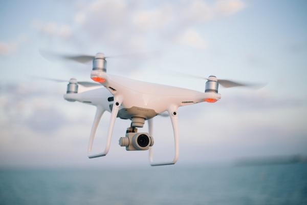
In the wake of increasingly volatile monsoon patterns, the integration of advanced technology into disaster management has shifted from a luxury to a critical necessity. A Gujarat-based startup, Prime UAV, has recently demonstrated the transformative potential of Unmanned Aerial Vehicles (UAVs) in flood-prone regions. By deploying specialized drone technology, the firm has provided rescue teams with unprecedented situational awareness, fundamentally changing how emergency services navigate submerged landscapes and locate stranded populations.
Traditional flood rescue operations are historically plagued by physical limitations, including impassable roads, submerged infrastructure, and the inherent dangers of navigating turbulent, debris-filled waters. The deployment of Prime UAV’s technology marks a strategic pivot toward digital-first disaster response, allowing ground teams to bypass these physical hurdles by gaining an immediate, high-definition perspective from the sky.
Enhancing Operational Efficacy Through Real-Time Intelligence
The primary advantage offered by drone technology in flood-ravaged sectors is the rapid acquisition of actionable intelligence. During the recent flood response efforts in Gujarat, Prime UAV’s fleet served as the "eyes in the sky" for rescue coordinators. Unlike satellite imagery, which can be delayed or obscured by heavy cloud cover common during monsoon events, drones provide localized, real-time data that is essential for high-stakes decision-making.
These aerial systems are equipped with advanced optical and thermal sensors, allowing rescue crews to identify trapped individuals even in low-visibility conditions or densely vegetated areas that are inaccessible to boats or helicopters. Furthermore, the drones enable precise mapping of flood-affected zones, helping authorities categorize regions by severity. This data-driven approach ensures that limited rescue resources—such as lifeboats, medical supplies, and emergency personnel—are deployed to the most critical locations with maximum efficiency, significantly reducing the "time-to-rescue" metric that is vital for saving lives.
Bridging the Gap Between Technology and Field Deployment
The successful integration of Prime UAV’s systems underscores a growing trend in the Indian agricultural and disaster-tech sectors: the transition of drone technology from a niche agricultural tool to a multi-purpose crisis management asset. While drones have long been utilized in precision farming for crop monitoring and pesticide spraying, the ability to pivot these tools for humanitarian relief highlights the versatility of the technology.
Beyond search and rescue, the startup’s deployment has facilitated a more organized logistical chain. By identifying which supply routes remain viable and which have been compromised by erosion or structural failure, the drones assist in establishing safe delivery corridors for food, potable water, and livestock fodder. This layer of aerial coordination minimizes the risk to rescue personnel, ensuring they are not sent into volatile zones without proper reconnaissance.
What This Means for Farmers
For the agricultural community, the emergence of localized, drone-based disaster response offers significant long-term implications that extend far beyond initial rescue operations:
- Rapid Damage Assessment: Following the retreat of floodwaters, farmers face the daunting task of assessing crop losses. Drone technology can be deployed post-disaster to provide high-resolution surveys of fields, allowing farmers to quantify damage for insurance claims and government relief packages with objective evidence rather than anecdotal reports.
- Infrastructure Monitoring: Drones provide a cost-effective method for farmers to inspect field boundaries, irrigation channels, and perimeter fencing after extreme weather events, identifying structural damage that may not be immediately visible from the ground.
- Data-Driven Recovery: By utilizing the mapping capabilities of UAVs, agricultural planners can better understand the drainage patterns of their land. This information is invaluable for future farm planning, helping producers identify which areas are most susceptible to waterlogging and where investment in land levelling or drainage infrastructure is most needed.
- Livestock Safety: In pastoral settings, drones can be utilized to locate displaced livestock, ensuring that farmers can recover assets efficiently before health complications arise from prolonged exposure to floodwaters.
As startups like Prime UAV continue to refine their aerial capabilities, the agricultural sector stands to benefit from a more resilient disaster-response ecosystem. By embracing these technologies, farmers can mitigate the economic shocks of extreme weather, ensuring that the path from disaster to recovery is shorter, safer, and more data-informed.